Physical Address
23,24,25 & 26, 2nd Floor, Software Technology Park India, Opp: Garware Stadium,MIDC, Chikalthana, Aurangabad, Maharashtra – 431001 India
Physical Address
23,24,25 & 26, 2nd Floor, Software Technology Park India, Opp: Garware Stadium,MIDC, Chikalthana, Aurangabad, Maharashtra – 431001 India

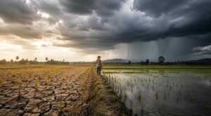
In August, Sri Lanka’s government asked its paddy farmers to plant two weeks early. Water releases, fertiliser distribution and the whole Maha calendar were to be pulled forward so that cultivation could begin in the first days of October rather than the middle of the month. The stated reason was not drought. It was the opposite: forecasts pointing to flood conditions around November.
The farmers have not agreed. The National Convention of Farmers says growers remain undecided, citing reservoir levels that are still too low to guarantee establishment, unresolved shortages of fertiliser and agrochemicals, and the risk that heavy October rain destroys the crop they have just been asked to plant early. It is a small dispute over a two-week window, and it captures the problem facing the whole region.
The timing is the story
South Asia has spent 2026 preparing for an El Niño drought. That preparation was correct, and the drought arrived. But the event itself is still strengthening. The World Meteorological Organization expects the intensification to peak around November. The U.S. Climate Prediction Center puts a 69 percent probability on the October to December quarter producing an event stronger than any recorded since 1950, and the U.K. Met Office describes what is developing as probably the largest since the 19th century.
India’s southwest monsoon withdraws through September. Sri Lanka’s Yala season is finishing now. Which means the damage the region has absorbed so far was inflicted by this El Niño in its weaker phase. The strongest phase lands squarely on the northeast monsoon, the Maha season and India’s rabi sowing window.
What the first half already cost
India entered August with cumulative seasonal rainfall running about 12 percent below the long period average, broadly tracking the IMD’s own forecast of 90 percent of LPA issued on May 29.The national figure conceals the shape of the season. June ran heavily deficient. July finished roughly one percent above average nationally, yet close to 47 percent of districts still recorded deficient or large-deficient rainfall in that period.
Kharif sowing has lagged accordingly, trailing the previous year by about 3.88 million hectares in late July. Storage is the more consequential number. As of the Central Water Commission bulletin dated 13 August, live storage across the 166 monitored reservoirs stood at 109.11 billion cubic metres, or 59.44 percent of capacity, against 135.64 BCM at the same point last year
The regional split matters more than the total. Southern India’s reservoirs were at 54.83 percent of capacity against 79.70 percent a year earlier. The northern region sat at 50.53 percent against 75.31 percent, and the central region at 57.01 percent against 73.88 percent. Every one of those regions goes into the post-monsoon period with less stored water than it had twelve months ago.
The power system is registering the same shortfall. Weak inflows have pushed hydropower output down and coal generation up, while analysts have warned the grid faces rising cooling demand at exactly the moment renewable output falls.
In Sri Lanka, the dry phase has been sharp enough that water bowsers are supplying roughly 23,000 families across seven of the island’s 25 districts. On 6 August the Ministry of Defence issued a circular granting emergency powers to bypass routine procedure in delivering water to drought-affected areas.
Why the signal flips in October
This is the part that is poorly understood outside the meteorological community, and it is the reason the second half of this event will not resemble the first.
El Niño suppresses the southwest monsoon. Over south peninsular India and Sri Lanka during October to December, it tends to do the reverse. Research published in the Journal of Climate found that while the relationship between ENSO and the Indian summer monsoon has weakened since around 1980, the relationship between ENSO and northeast monsoon rainfall over southern India and Sri Lanka has not weakened, and the associated circulation is modestly intensified.
Subdivision-level analysis of Coastal Andhra Pradesh, Rayalaseema, Tamil Nadu, South Interior Karnataka and Kerala points the same way, finding a high probability that northeast monsoon rainfall over the region lands in the normal or excess range during El Niño years. The physical mechanism is straightforward: El Niño shifts convection and moisture transport toward the western equatorial Indian Ocean and the Bay of Bengal, feeding the easterly flow that the northeast monsoon runs on.
The 2023 event is the working precedent. An El Niño-fuelled northeast monsoon contributed to the December deluge across southern Tamil Nadu. Peer-reviewed analysis of that episode found rainfall on 17 December 2023 exceeded the 100-year return period in Tirunelveli and Thoothukudi and the 50-year return period in Kanyakumari and Tenkasi, with flood modelling delineating over 150 square kilometres of inundation along the Thamirabarani basin.
Geography concentrates the risk. The narrowing gap between Tamil Nadu and Sri Lanka, across the Palk Bay and the Gulf of Mannar, funnels moisture-laden northeasterly winds onto both coasts at once. The same weather that floods Thoothukudi tends to arrive in Sri Lanka’s east within the same window.
Sri Lanka’s calculated gamble
This is why Colombo is moving its planting calendar rather than simply rationing water. Agriculture Minister K.D. Lal Kantha said the season would be brought forward by roughly a fortnight, explicitly because forecasts point to flood conditions in November. The Department of Agriculture has also encouraged short-duration paddy varieties maturing in two and a half to three months, and soil-moisture conservation measures, with a view to carrying more reservoir water into the following Yala season.
The underlying arithmetic is not desperate. At a July government briefing, the Mahaweli Authority’s Water Management Secretariat put national reservoir storage at around 65 percent, with Mahaweli-managed reservoirs at 71 percent and hydropower reservoirs at 60 percent, sufficient to support roughly 860,000 hectares of Maha cultivation and a stronger starting position than the island held during the 2015-16 El Niño. Sri Lanka’s Department of Meteorology has said only three El Niño events of comparable intensity were recorded between 1950 and 2025, and expects a significant rainfall increase in October and November followed by reduced rainfall from January to April.
What complicates the gamble is that the fields being replanted are not starting from neutral. Cyclone Ditwah damaged an estimated 60,863 hectares of paddy in late 2025, and recultivation ran into January. Asking farmers to advance a calendar into a forecast flood window, on land still recovering from the last one, is a reasonable request that carries an obvious downside if the timing is wrong.
India’s rabi question
For India, the enhanced northeast monsoon cuts both ways, and which way it cuts depends on intensity and distribution rather than seasonal totals.
Rabi sowing from October runs on stored water and residual soil moisture. Southern reservoirs sitting 25 percentage points below last year’s level are the exposure. A well-distributed northeast monsoon would refill them ahead of the rabi window and partially offset a poor kharif. A northeast monsoon delivering its seasonal total in a handful of extreme days would do the opposite: run off rather than recharge, damage standing crops in coastal Andhra Pradesh and Tamil Nadu, and leave the storage problem unsolved.
The distinction is the same one that has run through this monsoon season, where a national deficit figure concealed simultaneous flood and drought emergencies. Totals are the wrong unit. Timing and concentration are the right ones.
What is not settled
None of this is a forecast of floods. The Climate Prediction Center is explicit that an event of this magnitude raises the likelihood of El Niño-consistent impacts without guaranteeing them, and regional outcomes remain probabilistic. The northeast monsoon relationship is a statistical tendency across many events, not a prediction about this one.
The Indian Ocean Dipole adds further uncertainty. The WMO’s August to October update anticipates a positive phase developing, with a seasonal mean of 0.6°C, which typically supports rainfall over the subcontinent. Whether that reinforces or complicates the northeast monsoon signal will not be clear until the event approaches its peak. Analysts have argued through the year that the appropriate response to a strong El Niño is planning rather than alarm, and that holds here.
What can be said with confidence is that the region’s preparation to date has been organised around scarcity, and that the peak of the event arrives during the season when the historical signal points the other way. Sri Lanka has already restructured its disaster machinery toward anticipatory planning and expects drought now and flooding by November. The question for the coming ten weeks is whether water managers, disaster authorities and agriculture departments across southern India can hold both risks open at once, in the same districts, at the same time.
With inputs from CFC India.
References
https://www.cpc.ncep.noaa.gov/products/analysis_monitoring/enso_advisory/ensodisc.shtml
https://wmo.int/resources/publication-series/global-seasonal-climate-update/gscu-aso2026
https://www.pib.gov.in/PressReleasePage.aspx?PRID=2266479®=3&lang=1
https://www.fas.usda.gov/data/gain/2026/08/india-monsoon-recovery-fails-boost-sluggish-crop-planting
Reservoir storage below last year’s level across most regions; Western region bucks trend
https://cwc.gov.in/en/reservoir-level-storage-bulletin
https://academiccommons.columbia.edu/doi/10.7916/D8PN9G6P
https://www.ncbi.nlm.nih.gov/pmc/articles/PMC12686471
https://www.newsfirst.lk/2026/08/17/major-el-ni%C3%B1o-impact-on-sri-lanka-in-coming-months
https://www.themorning.lk/articles/Zg2afUce0AImdy8SX6wS
Sri Lanka prepares for impending El Niño with traditional and new approaches
A strong El Niño demands planning, not panic [Commentary]
Sri Lanka trucks water to 23,000 families as El Niño drought spreads across seven districts
Sri Lanka’s El Niño Outlook: Drought Now, Floods by November
Sri Lanka Moves to Overhaul Disaster Preparedness Ahead of a Potentially Severe 2026-2027 El Niño
When the Rains Fail, Coal Fills the Gap: El Niño Is Squeezing India’s Hydropower
El Niño May Push India’s Power Grid to the Limit as Cooling Demand Rises
One Monsoon, Two Disasters: What India’s Rainfall Deficit Does Not Tell You
Banner Image: AI-Generated
Sections of this article may have been developed with the assistance of artificial intelligence tools to support research, drafting and language refinement. All information has been reviewed, edited and verified by the author/editor to ensure accuracy, context and editorial integrity. The responsibility for the final content, interpretations and conclusions rests solely with the publisher.