Physical Address
23,24,25 & 26, 2nd Floor, Software Technology Park India, Opp: Garware Stadium,MIDC, Chikalthana, Aurangabad, Maharashtra – 431001 India
Physical Address
23,24,25 & 26, 2nd Floor, Software Technology Park India, Opp: Garware Stadium,MIDC, Chikalthana, Aurangabad, Maharashtra – 431001 India
By Aayushi Sharma with inputs from Dr Partha Jyoti Das
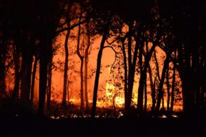
Many regions of India witnessed higher than ever forest fires in the month of February. Nearly 1,156 forest fires were reported from India between 13 to 20 February 2023, according to NASA’s Fire Information for Resource Management site (FIRMS).
Maharashtra reported 95 cases of forest fires in the first three weeks of February as compared to 35 cases in the same time frame last year. This is a more than 100% increase in such incidents, as reported by the Forest Survey of India. The fire that broke out in the Akkamalai grasslands,Tamil Nadu continued to rage for a week. On February 19, the fire that broke out in the Akkamalai grasslands, near Anamalai Tiger reserve in Tamil Nadu is the indigenous habitat of Nilgiri Tahr.
Why is India experiencing an early forest fire season this year?
Low humidity and high atmospheric temperatures provide favorable conditions for the forest fire to commence. This year’s early commencement to the forest fire season in India coincides with a hike in daytime temperatures ranging around 5 to 9 degrees Celsius above normal. The foremost reason for the earlier than normal onset of heat over northwest India is the lack of strong western disturbances, according to IMD.
The decline of La Niña conditions by March-April and the development of El Niño conditions later in the year could also mean further rise in temperatures and subsequent heat waves. Due to this El Niño, the 1.5°C barrier could be temporarily breached in 2024. Scientists have found that recent heat waves have been made more likely and intense by human-caused climate change.
Western disturbances are storm systems that originate from the Caspian Sea and move across the Afghanistan-Pakistan region to bring rains across northwest India. February 2023, experienced weak western disturbances. However, slight disturbances have led to some precipitation in Jammu and Kashmir but temperatures are 5-7 degrees above normal in the hilly states of Uttarakhand and Himachal Pradesh.
Consequences of Forest fires
Forest fires cause substantial impacts on both ecosystems and the economy. Forest fires result in forest degradation. About 3.73 million hectares of forest areas are affected annually in India. It results in loss of valuable timber resources and extinction of rare plants and animal species. Depletion of wild-life and habitat leads to a huge loss of biodiversity in the region where forest fires occur.
The smoke emitted from burning forests contributes to global warming. This smoke when inhaled by wild animals and people nearby leads to various respiratory diseases and also results in heart failure in certain cases. Precious forest resources including carbon locked in the biomass is lost due to forest fires every year, which adversely impact the flow of goods and services from forests. Loss of natural habitat affects the livelihood of tribal communities and rural people who depend on the forest for their living.
Climate Change: a contributor to forest fires
Forests are highly vulnerable to climate change because they grow along different altitudes and climatic zones—tropical, subtropical, temperate, and cold.
Forest fire occurrence is driven by many factors including:
Among these, climate change is a key factor contributing to forest fires, which mainly affects forest fires in two ways.
According to the UNEP, ‘climate change and land-use change are projected to make wildfires more frequent and intense, with a global increase of extreme fires of up to 14 per cent by 2030, 30 per cent by the end of 2050 and 50 per cent by the end of the century’ (UNEP, 2021).
The number of incidents of forest fire recorded in India has drastically increased in the recent past compared to the earlier decades. For example, the states of Madhya Pradesh, Maharashtra, Odisha, and Chhattisgarh experienced several forest blazes during 2018-2019. Other major instances are the Uttarakhand Forest fire (April-May 2016), fires in the Bandipur National Park Karnataka (February 2019), the fire in the Similipal Biosphere Reserve, Odisha (February-March 2021) are some of the examples from the recent times where the contribution of climate change impact is considered to be significant.
Forest fire scenario in India
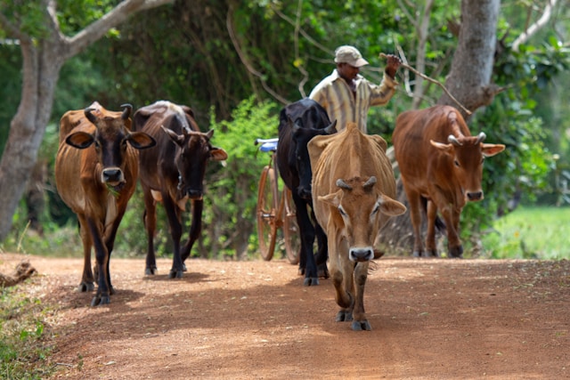
Every year large areas of forests in India are affected by fires of varying intensity and extent. Based on the forest inventory records, 54.40% of forests in India are exposed to occasional fires. Most forest fires are a result of anthropogenic activities either intentional or unintentional. Pine Forests and deciduous forests are the mostly affected forest types of the country. The most highly affected regions are the Western Himalayas, the North Eastern States and the Central highlands.
“Mizoram, Tripura, Meghalaya, and Manipur are the states of the region that have shown the highest forest fire probability in the country. Mizoram and Assam have found places in the list of the top 10 states in India ranked in terms of number of forest fires (12846 and 10718 respectively) observed during the period from November 2020 to June 2021. The districts of Karbi Anglong and Dima Hasao in Assam and Aizawl in Mizoram were among the top twenty districts with respect to the number of forest fires detected.” Says Dr. Partha Das, climate scientist and in-house expert CFC.
“Since the northeast is known for its practices of slash and burn cultivation (also called Jhum) on many occasions the forest fires were found to be incidents of landmass burning practices by the indigenous communities as part of the jhuming. In some cases, fires occurred or spread out accidentally from patches burnt for clearing spaces during shifting cultivation. However, the overall increase in susceptibility of the region to wildfires can be attributed to climatic factors as well as drastic changes occurring to the hilly landscapes due to anthropogenic intervention such as deforestation for commercial purposes and development activities as well as increased interaction of human beings with forestscapes.
The hilly region of the northeast shows remarkable spatial and temporal variability in distribution of rainfall, and many areas are reported to have passed through long dry periods throughout the year. Therefore, climatic conditions such as prolonged dry weather characterized with no or little rainfall, high air temperatures, drying of vegetation and trees and favorable windy situations (wind velocity and direction) in the post monsoon, winter and pre monsoon seasons is highly likely to have caused some of these fire events.
The wildfires that destroyed parts of the ecologically sensitive forests in the Dzüko Valley covering areas of Nagaland and Manipur during December 2020 to January 2021 is a reminder of how degraded ecological health could lead to and accentuate wildfires”, Dr. Das added.
How are the forest fire cases tackled in India?
The Forest Survey of India (FSI) has played a pivotal role in forest fire monitoring in the country since 2004 when satellite data based alerts of near real time detection of active forest fires first began. Satellite based remote sensing technology and GIS tools are effective measures used for better prevention and management of large scale forest fires through creation of Forest Fire Danger Rating System. FSI has launched the beta-version of the Large Forest Fire Monitoring Programme in 2019 using near real time SNPP-VIIRS data.
Real-Time monitoring helps in predicting and regulating large forest fires. It helps in:

The Satellite sends data to the data processing centers which alert the concerned state forest departments. A State action plan comprises guidelines for site-specific fire management. Thus, The State forest departments take the required suppression and mitigation measures to control blazing forest fires.