Physical Address
23,24,25 & 26, 2nd Floor, Software Technology Park India, Opp: Garware Stadium,MIDC, Chikalthana, Aurangabad, Maharashtra – 431001 India
Physical Address
23,24,25 & 26, 2nd Floor, Software Technology Park India, Opp: Garware Stadium,MIDC, Chikalthana, Aurangabad, Maharashtra – 431001 India

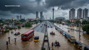
Colombo got 129mm of rain in hours against drains built for about 30mm. Here’s the science behind the flooding, the climate context and the city’s risk.
The sudden flooding experienced in several parts of Colombo on November 6, 2026, once again highlights Sri Lanka’s vulnerability to intense rainfall and the challenges of managing urban flooding. Following several hours of heavy rain, roads in the capital became inundated, traffic was severely disrupted, and daily activities were affected.
According to the Department of Meteorology, as reported by Newswire, Colombo recorded approximately 129 mm of rainfall within a few hours. The Department of Meteorology’s explanation of the flooding also highlighted that rainfall intensity exceeded 120 mm per hour in Colombo, while Mattakkuliya experienced rainfall intensity exceeding 135 mm per hour.
Such intense rainfall can overwhelm urban drainage systems, particularly when large volumes of water accumulate faster than they can be discharged.
Although heavy rainfall was the immediate trigger for the flooding, understanding why such rainfall occurs, how climate patterns influence it, and why its impacts are particularly severe in urban environments requires a broader scientific perspective.
Why does intense rainfall occur over Sri Lanka?
Sri Lanka’s geographical location, surrounding oceanic environment, atmospheric circulation patterns and complex topography create favourable conditions for different types of rainfall.
One important mechanism is low-level moisture convergence. This occurs when moisture-laden air currents move towards a particular region and converge. The accumulated moist air is forced upwards, where it cools and condenses, potentially producing heavy rainfall.
Another important mechanism is atmospheric instability. When warm, moist air near the surface rises through a relatively cooler atmosphere, it can develop into powerful convective clouds. These clouds, particularly cumulonimbus clouds, can produce intense rainfall, lightning, thunder and strong winds within relatively short periods.
The Intertropical Convergence Zone (ITCZ), where trade winds from the Northern and Southern Hemispheres converge, is another important influence on tropical rainfall. Its position and associated atmospheric circulation can contribute to the development of unstable weather conditions over and around Sri Lanka.
Sri Lanka’s second intermonsoon season, which generally occurs during October and November, is particularly associated with atmospheric instability, thunderstorms and convectional rainfall. During this period, rainfall can develop rapidly, sometimes following relatively sunny conditions earlier in the day. The Sri Lanka Department of Meteorology provides seasonal forecasts and weather information relevant to these patterns.
The country’s mountainous central region also influences rainfall distribution. Through a process known as orographic lifting, moist air moving towards elevated terrain is forced upwards, potentially producing enhanced rainfall on windward slopes. However, the extent to which this process contributes to rainfall in a particular location depends on wind direction and atmospheric conditions.
Another phenomenon associated with intense rainfall is the Mesoscale Convective System (MCS). An MCS is an organized collection of thunderstorms that can extend over a considerable geographical area and persist for several hours. Such systems can produce prolonged or intense rainfall and contribute to flash flooding.
These mechanisms help explain why Sri Lanka can experience sudden and intense rainfall. However, identifying the exact combination of atmospheric processes responsible for a particular event requires detailed meteorological observations, satellite imagery, radar data and atmospheric analysis.
El Niño and Sri Lanka’s rainfall patterns
Large-scale climate phenomena also influence rainfall patterns in Sri Lanka. One of the most important is El Niño, which is part of the El Niño–Southern Oscillation (ENSO) climate pattern in the tropical Pacific Ocean.
El Niño develops when sea surface temperatures in parts of the equatorial Pacific become warmer than average, influencing atmospheric circulation and rainfall patterns across different regions of the world.
The World Meteorological Organization (WMO), in its September 3, 2026 update, reported that El Niño was firmly established and expected to intensify into a very strong event in the coming months, potentially continuing into February 2027.
Similarly, NOAA’s Climate Prediction Center, in its October 8, 2026 ENSO Diagnostic Discussion, indicated that strong-to-very-strong El Niño conditions were likely to persist into early 2027.
El Niño can influence rainfall distribution across South Asia and the wider Indian Ocean region. In Sri Lanka, its influence can vary according to the season, geographical location and interaction with other climate systems.
The Sri Lanka Department of Meteorology’s seasonal forecasts and El Niño updates are useful resources for understanding how these large-scale climate conditions may influence the country’s seasonal weather.
However, El Niño should not be considered the direct cause of every heavy rainfall event. It influences large-scale climate conditions and seasonal probabilities rather than determining the occurrence of individual thunderstorms.
Other factors, including the Indian Ocean Dipole, the ITCZ, regional wind circulation and atmospheric instability, can also influence rainfall over Sri Lanka.
Climate change and the increasing risk of extreme rainfall
The world is experiencing long-term warming due to the accumulation of greenhouse gases, particularly carbon dioxide and methane, in the atmosphere.
One important consequence of global warming is the increased capacity of the atmosphere to hold water vapour. According to the Clausius–Clapeyron relationship, the atmosphere’s water-holding capacity increases by approximately 7% for every 1°C rise in temperature, provided other conditions remain comparable.
This does not mean that rainfall will increase by 7% everywhere. Rather, a warmer atmosphere can provide more moisture for precipitation when suitable atmospheric conditions develop.
The Intergovernmental Panel on Climate Change (IPCC), in its Sixth Assessment Report, Working Group I, Chapter 11, concludes that heavy precipitation events have generally become more frequent and intense over many land regions since the 1950s. The report also establishes that the intensity and frequency of heavy precipitation events are expected to increase with additional global warming in many regions.
This is particularly important for tropical countries, where intense rainfall can interact with existing vulnerabilities to produce significant flood impacts.
Nevertheless, the relationship between climate change and individual flooding events requires careful assessment. A particular flood may result from a combination of natural climate variability, atmospheric circulation, land-use changes, inadequate drainage and other local factors.
Research examining historical rainfall trends in Sri Lanka has also produced mixed results. For example, Thevakaran, Suppiah and Sonnadara (2019), in their study examining rainfall records from 13 meteorological stations between 1961 and 2010, found that extreme rainfall trends varied across the country rather than showing a consistent nationwide increase.
Another study by Nisansala and colleagues (2020), examining recent rainfall trends in Sri Lanka between 1987 and 2017, identified increasing rainfall trends at several stations during different monsoon seasons, while other locations showed different patterns.
Therefore, understanding whether particular types of extreme rainfall are becoming more frequent in Colombo requires long-term, location-specific observations. Nevertheless, the broader scientific evidence establishes that continued global warming increases the potential for more intense heavy precipitation.
Can such rainfall events be predicted?
Predicting rapidly developing thunderstorms and intense rainfall is among the challenging tasks in operational meteorology.
Conventional weather forecasts can identify favourable conditions for heavy rainfall several days in advance. However, predicting precisely where and when an intense thunderstorm will develop, and how much rain it will produce within a particular hour, is considerably more difficult.
This is where nowcasting becomes important.
Nowcasting refers to very short-term weather forecasting, generally covering the immediate future up to approximately six hours. It uses observations from weather radar, satellite imagery, rain gauges, lightning detection systems and numerical weather prediction models to monitor developing weather systems and estimate their short-term movement and intensity.
For example, Doppler weather radar can detect precipitation, estimate its intensity and monitor the movement and development of storm systems. This information can help meteorologists issue more targeted warnings about approaching heavy rainfall.
Sri Lanka has been working towards strengthening its weather observation and forecasting capabilities through the establishment of a Doppler weather radar system in Puttalam, with Japanese assistance through JICA.
According to the Japan International Cooperation Agency (JICA), construction began in December 2024, and the radar system is expected to be completed and become operational in 2027.
The radar is expected to improve the country’s capacity to observe developing weather systems and issue more timely short-term warnings. However, effective nowcasting also requires trained personnel, reliable communication systems, forecasting models and mechanisms to ensure that warnings reach vulnerable communities.
Even with advanced forecasting technologies, it is not always possible to prevent property damage from sudden flooding. Nevertheless, timely warnings can help people move to safer locations, protect essential belongings and take precautionary measures.
Why is Colombo particularly vulnerable to flooding?
The impact of intense rainfall depends not only on how much rain falls but also on the capacity of the surrounding environment to absorb, store and discharge water.
Colombo is a highly urbanized district with extensive buildings, roads, paved surfaces and other infrastructure. These surfaces are largely impermeable, meaning that a substantial proportion of rainfall becomes surface runoff rather than infiltrating into the soil.
In natural landscapes, vegetation and permeable soil allow rainwater to infiltrate, while wetlands, lakes and other water bodies provide temporary storage.
In heavily urbanized environments, however, rainwater moves rapidly across roofs, roads and paved surfaces towards drainage channels. When rainfall exceeds the capacity of these drainage systems, water accumulates on roads and in low-lying areas.
Blocked drains, inadequate drainage capacity, encroachment on waterways, inappropriate construction and the loss of natural water-retention areas can further aggravate the situation.
This is particularly important in Colombo, where wetlands and other natural ecosystems play a significant role in regulating stormwater. Protecting these ecosystems should therefore be considered an essential component of urban flood management rather than merely an environmental conservation activity.
The Ramsar Convention on Wetlands recognizes the importance of wetlands in maintaining ecological functions, including water regulation and flood-risk reduction.
The flooding experienced in Colombo demonstrates that improving drainage infrastructure and maintaining existing waterways must be treated as important priorities. Regular removal of solid waste, prevention of drainage obstructions, restoration of wetlands and improved urban planning can collectively reduce flood vulnerability.
The November 7 explanation from the Department of Meteorology also highlighted the contribution of blocked drainage systems to the flooding.
However, drainage maintenance alone cannot eliminate flooding during exceptionally intense rainfall. Urban drainage systems must also be assessed and upgraded according to present and future rainfall risks.
Reducing disaster risk: What can be done?
Although extreme rainfall cannot always be prevented, its impacts can be reduced through effective disaster-risk management.
In urban areas, local authorities should prioritize maintaining drainage networks, protecting wetlands, restoring natural waterways and improving stormwater management infrastructure.
Urban development policies should also recognize the importance of permeable surfaces, green spaces, retention ponds and other nature-based solutions that help reduce surface runoff.
At the household level, people should avoid disposing of solid waste into drains and waterways. Those living in flood-prone areas should understand local evacuation routes, monitor official weather warnings and prepare essential supplies.
People living near rivers, streams and other flood-prone locations should consider preparing a disaster emergency bag containing drinking water, essential medicines, identification documents, a flashlight, batteries, basic food supplies and other necessities.
The Disaster Management Centre of Sri Lanka provides disaster-related information, warnings and preparedness guidance that the public can use.
Most importantly, disaster preparedness should not begin only when flooding occurs. It requires continuous awareness, community cooperation and regular engagement with local authorities.
Poverty, inequality and the human impacts of disasters
One of the most important dimensions of climate-related disasters is their unequal impact on different sections of society.
Extreme rainfall does not affect everyone equally. Households with limited financial resources often have fewer opportunities to improve housing conditions, relocate from high-risk areas, purchase insurance or recover quickly after a disaster.
People living in poorly constructed houses, low-lying settlements and areas with inadequate infrastructure can face significantly higher risks.
A household with sufficient financial resources may be able to repair flood damage, temporarily relocate or replace damaged belongings. For a low-income household, the same event can result in the loss of essential possessions, income, employment opportunities and long-term financial stability.
Therefore, poverty and socioeconomic inequality are important determinants of disaster vulnerability.
Disaster management should not focus exclusively on forecasting rainfall or constructing infrastructure. It should also address the underlying social and economic conditions that determine people’s ability to prepare for, withstand and recover from disasters.
Accessible early-warning systems, effective evacuation arrangements, social protection, resilient housing and community-based disaster preparedness are essential components of this process.
Is this the future we should prepare for?
The scientific evidence is clear that continued global warming increases the risk of intense precipitation in many parts of the world. At the same time, rapid urbanization, environmental degradation and inadequate infrastructure can make the consequences of heavy rainfall more destructive.
Sri Lanka is particularly exposed to these combined challenges because of its tropical climate, seasonal rainfall variability, geographical characteristics and the growing pressure on urban and natural ecosystems.
The flooding in Colombo should therefore be understood not simply as an isolated incident or a temporary inconvenience but as an important reminder of the need to strengthen the country’s climate resilience and disaster preparedness.
Governments, local authorities, environmental organizations, scientists and communities all have important roles to play.
Protecting wetlands, improving drainage infrastructure, strengthening meteorological observation systems, implementing effective land-use policies and addressing socioeconomic vulnerabilities should become continuous priorities.
Most importantly, public awareness and preparedness should not be limited to the days when floods dominate the news. Building a disaster-resilient society requires consistent action throughout the year.
We cannot prevent every extreme weather event. But through scientific understanding, responsible environmental management, effective governance and collective preparedness, we can significantly reduce the damage these events cause to people’s lives and livelihoods.
References
Colombo records 129mm of rainfall within hours
Why Colombo flooded within hours: Met Department explains
https://www.britannica.com/science/intertropical-convergence-zone
https://www.ipcc.ch/report/ar6/wg1/chapter/chapter-11
https://dl.nsf.gov.lk/items/cc05f2ed-529f-4d19-a5ad-d26f79228aae
https://rmets.onlinelibrary.wiley.com/doi/10.1002/joc.6405
https://www.sciencedirect.com/topics/earth-and-planetary-sciences/nowcasting
https://www.jica.go.jp/english/overseas/srilanka/information/press/2024/20241223.html
Why Colombo flooded within hours: Met Department explains
Sections of this article may have been developed with the assistance of artificial intelligence tools to support research, drafting and language refinement. All information has been reviewed, edited and verified by the author/editor to ensure accuracy, context and editorial integrity. The responsibility for the final content, interpretations and conclusions rests solely with the publisher.