Physical Address
23,24,25 & 26, 2nd Floor, Software Technology Park India, Opp: Garware Stadium,MIDC, Chikalthana, Aurangabad, Maharashtra – 431001 India
Physical Address
23,24,25 & 26, 2nd Floor, Software Technology Park India, Opp: Garware Stadium,MIDC, Chikalthana, Aurangabad, Maharashtra – 431001 India

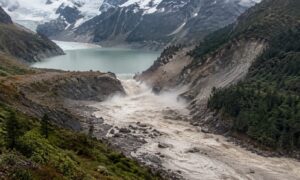
A glacial lake burst in Bhutan’s Gasa on Oct 29, washing away Gasa Tshachu and putting Assam and Bengal on alert. What we know about the cause.
For most of the year, Sintaphu Tsho sits unremarked in the high country of northern Bhutan, a pool of grey meltwater below Wakila mountain that few people outside the cryosphere community could place on a map. On the evening of Thursday, October 29, 2026, it emptied itself into the Mo Chhu river, and within hours its name was being read out in disaster control rooms in Thimphu, Siliguri and Dhubri.
No lives were lost. That single fact is worth stating early, because it is the result of years of monitoring work. But the flood also washed away a beloved hot spring, cut the only road to one of Bhutan’s most remote settlements, and put two Indian states on alert. Here is what is known so far, what is still unconfirmed, and what set the stage.
What happened
The outburst was reported on Thursday evening at Sintaphu Lake near Wakila Mountain in Lungo, Laya Gewog, in Gasa district. The lake is also spelt Shintaphu, which is why reports have used both names. It sits at the headwaters of the Mo Chhu, which flows south through Gasa and Punakha.
According to Daily Bhutan, as summarised by epardafas, floodwater reached Taktsimakhang at around 8:15 pm and destroyed a stretch of the road to Laya. Preliminary estimates put the volume released at roughly 7.4 million cubic metres, which is about 3,000 Olympic-size swimming pools of water and debris moving down a narrow mountain valley.
The most visible casualty was Gasa Tshachu, the natural hot spring complex on the banks of the Mo Chhu. The flood washed away its infrastructure, and Bhutan’s state broadcaster BBS said two Bailey bridges may also have gone. A section of the Punakha-Gasa highway near the 31.85 km mark was lost completely, and the road is closed until further notice. Downstream, debris covered part of the highway at Dzomlingthang and a solar irrigation system stopped working.
The area had been evacuated before the water arrived, and no injuries have been reported. Bhutan’s National Centre for Hydrology and Meteorology (NCHM) is tracking river levels at Tashithang and Yebesa, sirens were sounded along the Mo Chhu and the Punatsangchhu, and the Punatsangchhu II hydropower plant stopped generating and opened its spillway gates to pass the flood and its debris.
Why Assam and North Bengal were alerted
At Punakha, the Mo Chhu joins the Pho Chhu to form the Punatsangchhu, which enters India as the Sankosh and runs along the West Bengal-Assam border before meeting the Brahmaputra. The Central Water Commission issued a special flood advisory on October 29, based on information from the Indian Embassy in Bhutan, warning of a sudden rise in water levels in Alipurduar and Dhubri districts.
West Bengal moved thousands of people along the Sankosh and its tributaries to safer ground, with residents of the Darjeeling hills, Terai and Dooars asked to stay alert. By the time a flood wave travels several hundred kilometres to the plains it is usually far weaker, but the advisories were a sensible precaution: GLOFs carry boulders, timber and sediment, and can temporarily block valleys. One post shared in news coverage warned that an artificial lake had formed upstream; that claim had not been confirmed by NCHM at the time of writing.
Sintaphu or Lemthang? Clearing up the name
Some early Indian reports, and a widely shared post by a Darjeeling MP, said the outburst happened at Lemthang. NCHM’s own notice, reproduced by The Bhutanese, names Sintaphu Lake in the Mo Chhu basin. The confusion is understandable. Lemthang Tsho is a different lake in the same Mo Chhu catchment, and it was the source of an earlier outburst in 2015, when two interconnected ponds on the glacier above it drained suddenly. Readers sharing updates should use Sintaphu (or Shintaphu) for the October 2026 event.
What triggered it: the honest answer is “not yet known”
As of Friday morning, officials had not confirmed the cause of the outburst, the exact volume released or the full extent of damage. Any post claiming a definite trigger is getting ahead of the evidence. NCHM teams will need field visits and satellite imagery to establish what happened at the lake.
What science can say is how lakes like this one generally fail. Most Himalayan glacial lakes are held back by moraines, loose heaps of rock and soil that a glacier bulldozed into place and then abandoned as it retreated. These natural dams were never engineered. A GLOF can begin when water pressure builds as meltwater accumulates, when ice, rock or snow avalanches into the lake and pushes out a surge wave, when a landslide strikes the dam, or when an earthquake shakes it. Buried ice inside a moraine can also melt slowly, weakening the dam from within. Often it is a combination.
Sintaphu was not a surprise candidate. A 2021 hazard study of the Mo Chhu basin singled it out and concluded that its size and the short distance to its glacier justified listing it as potentially dangerous. Bhutanese experts surveyed the lake again in May and June 2023, measuring the main and upper lakes, testing the natural dam and studying the glacier that feeds it, and installed monitoring equipment there.
The bigger picture: why Bhutan’s lakes keep growing
The underlying driver is not in doubt. Bhutan’s glaciers are shrinking, and as they pull back they leave hollows that fill with meltwater. An ICIMOD satellite inventory found that Bhutan lost about 23 percent of its glacier area between 1980 and 2010, with the snowline creeping upward over the same period. A more recent international study of the wider Bhutanese Himalaya reported that the annual rate of glacier area loss rose from about 0.38 percent (1976 to 1998) to about 0.95 percent (1998 to 2024), with the fastest retreat among glaciers that end in lakes, and many new lakes forming as the ice withdrew.
Bhutan now has more than 600 glacial lakes, 17 of them classed as potentially dangerous. Of those 17, nine are in the Pho Chhu sub-basin and two in the Mo Chhu, Sintaphu being one. A potentially dangerous label does not mean a burst is certain; it means the lake needs continuous watching.
The country has paid for these hazards before. In October 1994, a partial moraine collapse at Luggye Lake in Lunana sent a flood down the Pho Chhu that killed 21 people. Just this August, a small flood occurred at Jichu Drakey, and the deadly floods on the Nepal-Tibet border on August 26 had already prompted renewed concern in Bhutan about its own exposure. A 2026 modelling study estimated that more than 11,000 people, over 2,500 buildings and more than 400 bridges in Bhutan are exposed to potential GLOFs, including several local areas not previously flagged as at risk.
What worked, and what India can take from it
The difference between October 29 in Gasa and October 2023 in Sikkim is instructive. When South Lhonak lake burst into the Teesta, the flood killed 46 people, left more than 77 missing, and the early warning system for that lake was still being installed when it failed. In Bhutan, the warning network in the Mo Chhu sub-basin has been in place since 2013, and the sirens and evacuations bought enough time for everyone in the hot spring area to get out.
For India, the lesson cuts across the whole Himalayan arc, not just the Northeast. Sikkim, Uttarakhand and Himachal Pradesh are among the states most exposed to glacial lake floods, and the Sankosh alert is a reminder that a hazard born in another country can still reach Indian districts within hours. Upstream monitoring is only half the system. The other half is fast cross-border data sharing, rehearsed evacuations and local communities that trust the siren when it sounds.
What to watch for next
NCHM’s field assessment should establish what triggered the outburst, how much of the lake drained and whether the remaining lake and its dam are stable. Until then, treat claims of a confirmed cause, casualty figures that differ from official counts, and old flood videos recycled as “Gasa today” with caution. Climate Fact Checks will update this piece as verified information comes in.
Also Read:
No Rain, No Warning: How a Silent Mountain Collapse Triggered Nepal’s Deadly Torrent
What Is a GLOF? Nepal’s Bhotekoshi Flood Explained
Has Climate Change led to the devastating floods in Sikkim?
References
Glacial lake outburst in Bhutan triggers flash flood alerts in West Bengal and Assam
Monitored Glacial Lake Bursts In Bhutan Following Installation Of Equipment
https://www.yahoo.com/news/articles/bhutan-glacial-lake-outburst-triggers-025354766.html
https://servirglobal.net/news/investigating-lemthang-tsho-lake-outburst-bhutan
Addressing Transboundary GLOF Risks in Eastern Himalayas
https://www.mdpi.com/2076-3417/11/20/9463
https://lib.icimod.org/records/hmkz7-6gk25
Glacier retreat surges across Bhutanese Himalayas
https://earthobservatory.nasa.gov/images/40962/thorthormi-glacier-lake-bhutan
Nepal disaster’s alarms over Bhutan’s glacial lake hazards
https://apps-eprint4-l.ncl.ac.uk/310010
https://iee.psu.edu/news/blog/glacier-lake-outburst-floods-loss-life-and-infrastructure
https://en.wikipedia.org/wiki/2023_Sikkim_flash_floods
Banner Image: AI Generated
Sections of this article may have been developed with the assistance of artificial intelligence tools to support research, drafting, and language refinement. All information has been reviewed, edited, and verified by the author/editor to ensure accuracy, context, and editorial integrity. The responsibility for the final content, interpretations, and conclusions rests solely with the publisher.