Physical Address
23,24,25 & 26, 2nd Floor, Software Technology Park India, Opp: Garware Stadium,MIDC, Chikalthana, Aurangabad, Maharashtra – 431001 India
Physical Address
23,24,25 & 26, 2nd Floor, Software Technology Park India, Opp: Garware Stadium,MIDC, Chikalthana, Aurangabad, Maharashtra – 431001 India
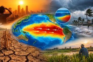
The Pacific Ocean may seem far removed from our everyday lives, but what happens there can eventually show up in our kitchens, our cities, and even our electricity bills. Right now, scientists are watching the ocean closely as El Niño, one of the world’s most influential climate patterns, strengthens rapidly.
According to the World Meteorological Organization (WMO), El Niño is now firmly established and could become even stronger in the months ahead. Forecasts suggest that the phenomenon could remain in place into early 2027, raising concerns about the weather disruptions it could bring across different parts of the world. El Niño is not a storm or a disaster in itself. It is a natural climate phenomenon that begins with unusually warm waters in the central and eastern tropical Pacific Ocean. But that seemingly distant change can disturb atmospheric circulation and alter rainfall and temperature patterns thousands of kilometres away. And that is where the real concern begins.
The Pacific Is Sending a Strong Signal
The speed at which the current El Niño has developed has caught attention. Sea-surface temperatures in the key Niño 3.4 region were already around 1.5°C above average during May-July 2026. By July, the difference had grown to about 2°C, while temperatures between late July and mid-August were roughly 2.2°C to 2.6°C above normal. There is also a considerable amount of heat stored beneath the surface of the Pacific. In some areas, subsurface waters were more than 8°C warmer than average. This hidden heat matters because it can help sustain the event and influence how it develops in the coming months.
Some forecasts indicate that the sea-surface temperature anomaly could rise as high as 3.6°C. If that happens, the event could become one of the strongest El Niño episodes seen during the modern observation period. But numbers alone do not tell the whole story.
A powerful El Niño does not mean that every country will suddenly experience extreme heat or drought. Its effects vary considerably depending on location, season and how it interacts with other climate systems. In one part of the world, it can contribute to prolonged dry conditions; somewhere else, it can increase the risk of heavy rain and flooding. That unpredictability is precisely why scientists and governments are paying attention.
India Has More Than One Climate Factor to Watch
For India, the development is particularly important because of the country’s dependence on the monsoon. Rainfall is closely linked to agriculture, groundwater recharge, reservoirs, hydropower, and the availability of water for millions of people.
The latest WMO outlook points towards a tendency for drier-than-normal conditions over the Indian subcontinent during September-November 2026. But there is an important twist: El Niño will not be acting alone. The Indian Ocean Dipole (IOD), another major climate driver, is expected to move towards a positive phase during the same period. A positive IOD can influence rainfall over India and potentially counter some of the typical effects associated with El Niño.
This is a reminder that the climate system does not work like a series of separate switches. Oceans, winds, temperatures, and atmospheric circulation are constantly interacting with one another. A change in one region can set off a chain of effects elsewhere. For people, however, the science eventually comes down to very practical questions: Will there be enough rain? How hot will the summer become? Will crops receive adequate water? Could electricity demand rise because of higher temperatures? Will reservoirs and groundwater be under additional pressure?
These questions become even more important because El Niño is developing on top of a planet that is already getting warmer. Natural climate variations such as El Niño have always occurred. But global warming can raise the background temperature, meaning that an El Niño event starts from an already warmer baseline. This can increase the pressure on communities dealing with heat, water shortages, wildfires or other weather extremes. The WMO’s message, therefore, is not that a particular disaster is guaranteed. It is that there is now enough information to prepare.
Early warnings can give farmers time to adjust cropping decisions. Water managers can plan reservoir operations. Cities can strengthen heat preparedness. Disaster-management agencies can identify vulnerable areas before extreme weather arrives. The coming months will determine just how strong this El Niño becomes. For now, the Pacific is giving scientists a clear signal: something significant is developing, and waiting for the impacts to appear may be the costliest option. The real opportunity lies in using the warning while there is still time to prepare.
References:
https://wmo.int/news/media-centre/el-nino-set-become-very-strong-raising-risks-of-extreme-weather-2027
https://wmo.int/themes/el-nino-la-nina-phenomena
https://www.sciencedirect.com/science/article/abs/pii/S0048969725007168
https://news.un.org/en/story/2026/09/1168265
Banner Image: AI-generated
Sections of this article may have been developed with the assistance of artificial intelligence tools to support research, drafting, and language refinement. All information has been reviewed, edited, and verified by the author/editor to ensure accuracy, context, and editorial integrity. The responsibility for the final content, interpretations, and conclusions rests solely with the publisher.