Physical Address
23,24,25 & 26, 2nd Floor, Software Technology Park India, Opp: Garware Stadium,MIDC, Chikalthana, Aurangabad, Maharashtra – 431001 India
Physical Address
23,24,25 & 26, 2nd Floor, Software Technology Park India, Opp: Garware Stadium,MIDC, Chikalthana, Aurangabad, Maharashtra – 431001 India


The northeast monsoon set in on October 15, and orange alerts now cover the Cauvery delta. With south India 24% short on rain, here’s what the season means.
In the Cauvery delta, the sluice gates of Mettur were due to close on October 15, with the reservoir sitting close to dead storage. On the same day, a few hundred kilometres away, the clouds finally turned. The India Meteorological Department announced that the northeast monsoon had set in over Tamil Nadu, Puducherry, Kerala, coastal Andhra Pradesh and south interior Karnataka.
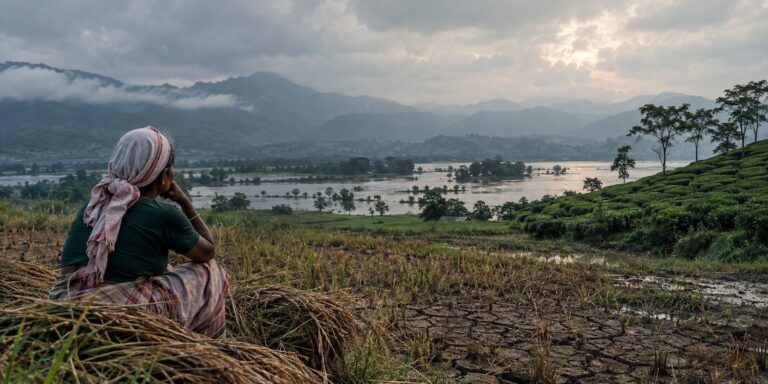
For farmers watching samba paddy wilt along dry canals, and for cities whose lakes have been shrinking since summer, the timing could hardly be more important. After a southwest monsoon that left the south nearly a quarter short of rain, the question now is simple: can the northeast monsoon make up the difference?
What is the northeast monsoon?
Most of India gets the bulk of its rain from the southwest monsoon, which runs from June to September. When those moist southwesterly winds retreat, the wind pattern over the Bay of Bengal reverses. From October to December, winds blow from the northeast, picking up moisture over the Bay and dropping it on the southeastern coast of the peninsula.
This is the northeast monsoon, also called the post-monsoon or winter monsoon. Much of its rain arrives not as a steady seasonal flow but through low-pressure systems, depressions and cyclones that form over the Bay of Bengal, which is why the season can swing quickly between drought and flood.
Tamil Nadu depends on it more than any other state. The northeast monsoon delivers nearly half of the state’s annual rainfall, and for coastal districts like Chennai it is the main rainy season. Puducherry, Rayalaseema and south coastal Andhra Pradesh also rely on it heavily, while Kerala and south interior Karnataka receive a significant second spell.
This year’s onset
On October 15, IMD said the southwest monsoon had withdrawn from the entire country and, on the same day, northeast monsoon rain began over Tamil Nadu, Puducherry and Karaikal, coastal Andhra Pradesh, Rayalaseema, south interior Karnataka, and Kerala and Mahe.
IMD forecast fairly widespread to widespread rain over Tamil Nadu until October 19, with isolated very heavy rain on the first two days, and widespread rain over Kerala and south interior Karnataka until October 21. Strong surface winds were forecast along coastal Andhra Pradesh. A cyclonic circulation off the Kerala coast was also influencing weather over the southern peninsula.
The wet spell has since been extended. On October 19, the Regional Meteorological Centre in Chennai issued orange alerts for heavy to very heavy rain in the Cauvery delta districts of Thanjavur, Thiruvarur, Nagapattinam, Mayiladuthurai and Pudukkottai, along with the Nilgiris and Coimbatore, Karaikal, and Puducherry. Orange alerts for October 21 cover southern districts including Tirunelveli, Tenkasi, Theni, Virudhunagar and Kanniyakumari, and rain is forecast across 23 districts until at least October 25. The Met office linked the spell to an upper-air cyclonic circulation over the southwest Bay of Bengal, off the north Tamil Nadu coast.
For the delta, the timing matters. These are the same districts where samba paddy has been struggling for water since canal releases fell short, so the coming days could decide how much of the standing crop survives.
Why this season matters more than usual
South India enters the northeast monsoon from a weak position. Over June to September, the South Peninsula received about 24% less rain than normal. Karnataka was 30% short, Kerala 28%, Andhra Pradesh 24%, Tamil Nadu 20% and Puducherry 39%, according to IMD figures compiled by Down To Earth. Nationally, the southwest monsoon delivered 87% of its long-period average, the 13th-lowest season since 1901.
The shortfall shows in Tamil Nadu’s reservoirs. At the start of October, the state’s 90 dams held about 76.4 thousand million cubic feet (tmcft) of water, roughly 34% of their combined capacity. Sixty-three reservoirs were below 25% of capacity, and officials warned that drinking water supply could come under pressure in several districts if dry conditions continued.
In the Cauvery delta, the Mettur dam stood at about 59 feet with roughly 24 tmcft of storage on October 14, close to dead storage. Water released for delta irrigation from September 1 did not reach many branch canals and tail-end fields, and some samba paddy that had already been planted was withering. Farmers there are counting on the northeast monsoon to recharge groundwater and save part of the crop.
What is the forecast for the season?
IMD’s seasonal outlook, issued at the end of September, expects normal rainfall over south peninsular India for October to December, in the range of 88% to 112% of the long-period average. For the country as a whole, it forecast below-normal rainfall in October, along with above-normal maximum temperatures in many regions.
A normal northeast monsoon would help, but it is not a guarantee of recovery. Reservoirs that start the season low need more than an average year to fill. Silt in poorly maintained dams also reduces how much water they can actually hold. And because much of the season’s rain comes from a handful of intense systems, a normal seasonal total can still mean long dry spells punctuated by a few days of extreme rain.
The other risk: too much rain, too fast
The northeast monsoon is also when Chennai and other coastal cities face their worst floods. Bay of Bengal depressions and cyclones can drop very heavy rain over a short period, overwhelming urban drains. Many Indian stormwater drains were designed for rainfall of around 25 mm per hour, while several cities now record more than 100 mm in a single day. Research cited by Mongabay India found that in Chennai, the risk of hospitalisation for gastrointestinal illness was 60% higher in the 15 days after extreme rainfall.
So the season carries a double edge. South India needs the rain to refill reservoirs and rescue crops, but the way it falls matters as much as how much falls. Steady rain over several weeks recharges groundwater and fills tanks. A few intense downpours can flood streets, damage standing crops and run off before the soil can absorb them.
The bottom line
The northeast monsoon has arrived on time, and its first week has brought widespread rain to the south, with heavy rain alerts extending into the last week of October. For a region coming off a dry southwest monsoon, with reservoirs at about a third of capacity in Tamil Nadu, the next ten weeks will decide whether 2026 ends as a drought year or a recovery year. The answer will depend not only on how much rain falls, but on when, where and how hard it comes down.
References
https://mausam.imd.gov.in/Forecast/marquee_data/Press Release 15-10-2026.pdf
https://www.newkerala.com/news/a/tn-dams-34-pc-capacity-drinking-water-concerns-852.htm
https://www.dtnext.in/news/tamilnadu/farmers-look-up-to-sky-as-mettur-shutters-to-shut-on-october-15
https://minnambalam.com/northeast-monsoon-rain-tamil-nadu-orange-alert-october-19
https://www.uniindia.com/south-india/weather-tn-rains-19ms18/218982
A changing climate is reshaping India’s infectious disease risks
Banner Image: Photo by 🇻🇪 Jose G. Ortega Castro 🇲🇽 on Unsplash
Sections of this article may have been developed with the assistance of artificial intelligence tools to support research, drafting, and language refinement. All information has been reviewed, edited, and verified by the author/editor to ensure accuracy, context, and editorial integrity. The responsibility for the final content, interpretations, and conclusions rests solely with the publisher.