Physical Address
23,24,25 & 26, 2nd Floor, Software Technology Park India, Opp: Garware Stadium,MIDC, Chikalthana, Aurangabad, Maharashtra – 431001 India
Physical Address
23,24,25 & 26, 2nd Floor, Software Technology Park India, Opp: Garware Stadium,MIDC, Chikalthana, Aurangabad, Maharashtra – 431001 India
What are mangrove ecosystems?
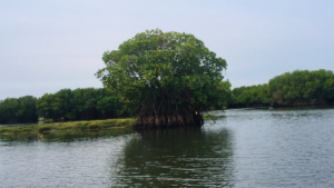
A mangrove is a shrub or tree that grows in coastal saline or brackish water. The term is also used for tropical coastal vegetation consisting of such species.
Mangroves are one of the most productive ecosystems in the world. They may be either shrubs or small trees and primarily marginalize the intertidal zone along with sheltered coastal, estuarine and riverine areas in tropical and subtropical latitudes, and they also occur in coastal lagoons and the supra-littoral zone. Mangroves adapt well to high salinity, extreme tides, high temperatures, strong wind, and anaerobic soils.
Mangroves spread across 123 countries in the world, in tropical and warm temperate countries. It was estimated that about 152,000 km2 of the global areas are mangrove ecosystems. That means mangroves occupy about 0.12% of the Earth’s terrestrial surface. Among them, Indonesia is the country that has the largest mangrove coverage in the world, representing 25.79% of the global total.
This Article will cover
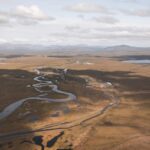
Mangroves distribution in Sri Lanka
In Sri Lanka, mangrove coverage of the island is only about 0.1–0.2% of the total land area. Mangrove vegetation can be found in Sri Lanka along the coastal belt, covering 14 districts. Jaffna, Kilinochchi, Mullaitivu, Trincomalee, Batticaloa, Ampara, Hambantota, Matara, Galle, Kalutara, Colombo, Gampaha, Puttalam and Mannar.
The largest mangrove ecosystem is associated with the Puttalam-Kalpitiya lagoon. And the second largest ecosystem can be found in the Jaffna peninsula. The third largest mangrove ecosystem is located in the Trincomalee – Batticaloa patch. The low population density in the North-West and East of Sri Lanka could be the main reason for the above results.

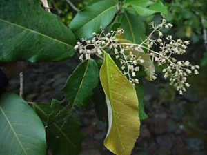
The below family of species of vegetation can be found in Sri Lankan Mangrove Ecosystems
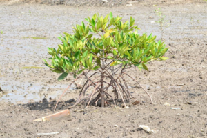
There are five types of mangroves based on topography.
Among them, riverine and fringing mangroves are the most common types on the island. Species distribution in these mangroves shows considerable differences, even though they are in the same climatic region or geography. This may be due to changes in hydrology, soil salinity variations, and other edaphic factors such as soil nutrition, texture, and bulk density in the area.
Mangroves from the East of Sri Lanka
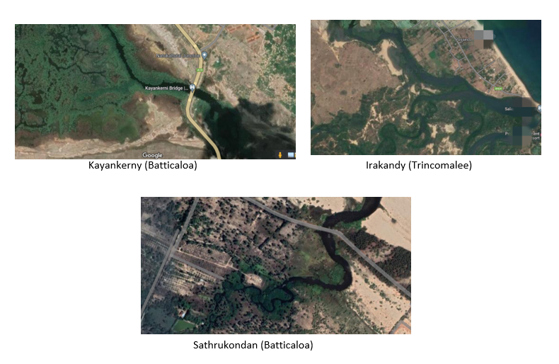
Eastern province contains 50.84km2 of mangrove ecosystem. Trincomalee has a higher distribution of mangroves than the other 2 districts.
Trincomalee – 23.95km2
Batticaloa – 20.71km2
Ampara – 6.18 km2
Within these three districts, there are 4 major lagoons associated with mangrove vegetation. In Trincomalee, there are 2 lagoons, namely, Trincomalee lagoon and Irakandy lagoon. The Batticaloa lagoon is in the Batticaloa district, and Pottuvil/Panama lagoons are associated with Mangrove vegetation in the Ampara district. Most of the mangroves in the Batticaloa district are also distributed as patches, and the extent of each mangrove patch is less than 0.05 km2. Large patches of mangroves can be found in Trincomalee. The country’s east coast contains 28-40% of mangrove vegetation, which include almost 25 mangrove species. avicennia marina (In Sinhala – මොටමුණ්ඩ , in Tamil –கண்ணை ) dominated in the area and Heritiera littoralis ( in Sinhala – ඇටුණ , in tamil – சொன்முந்திரி) found to be very rare.
Between the years 1980 and 2005, approximately 25% of mangrove habitats are estimated to have been destroyed. Mangroves in Sri Lanka are seriously threatened due to development activities such as hotel building and expanding human settlements along the coastal line. Also, urbanization, water pollution, erosion, and prawn farming are recent major threats to mangrove ecosystems. Especially wastewater from aqua ponds further degrades this vegetation. During dry seasons farmers allow cattle to graze on mangroves, thereby posing a threat to these ecosystems.
Overexploitation of mangroves for traditional uses, the growing population in the coastal region, and land clearance for human settlements are some of the major and common problems for the mangrove destruction on the island. Unsustainable tourism in eastern Sri Lanka is another reason for mangrove vegetation degradation.
The present state of mangrove ecosystems in the Eastern Province
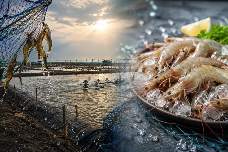
Mangrove utilization on the island may be a traditional practice of the nation, and the poverty of the local people may be a reason for them to use the mangroves. Locals mainly utilize the mangrove areas to capture fish, crab, shrimp, and bivalves, sell them for small markets, and use them for household consumption. Also, Leaves of Avicennia spp. are used by the locals as agricultural manure, while the stem is used as firewood and wood is used for home construction, and Branches of Avicennia spp. are used for Brush pile traditional fisheries. In the eastern part, mangroves are dominated by Avicennia spp. Therefore, people easily use mangrove vegetation for their purposes.
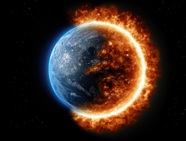
How does Climate Change affect mangrove vegetation?
Mangroves substantially reduce the vulnerability of the coastal region by inundation and erosion. But at present, climate change poses a large threat to mangroves. The greatest risk is in East Asia, especially in Indonesia, the Philippines, and Myanmar. In Sri Lanka, mangrove areas located close to densely populated urban or rural settlements are often vulnerable to degradation.
Climate change poses a number of threats to mangroves. Rise in sea level, rise in atmospheric CO2, rise in air and water temperature, and change in frequency and intensity of precipitation and storm patterns.
In Sri Lanka, conserving and expanding mangroves is a national goal formulated in recent policies, plans, and strategies. It is also a priority for climate change adaptation and resilience.
Sea level increasing is a considerable climate issue in Sri Lanka because it’s an Island nation. The mangrove ecosystem is all around the country’s coastline. Therefore, seawater entering the mangrove vegetation causes salinity to increase in the ecosystem.
Mangrove dynamics are also affected by soil erosion, intense storms, tsunami conditions, changes in freshwater run-off, salinity regime and tidal flow patterns, changing sea levels, and excessive siltation.
Soil erosion leads to the degradation of mangroves. Moreover, if the mangrove stretch is already degraded due to reduced sediment inflow (upstream dams), tree felling, and pollution, then an already eroding shoreline goes through further cycles of erosion, causing excessive loss.
Mangroves are essential for both climate change mitigation and adaptation. On the one hand, they store large amounts of carbon both in the trees and below the soil, thereby removing greenhouse gas emissions from the atmosphere; on the other hand, they can be the centerpieces of a strategy of ecosystem-based adaptation through coastal disaster risk reduction, various ecosystem services, sources of livelihoods, and conservation of coastal and marine biodiversity.
Conventions, Mandates, and Legal Protection in Sri Lanka
At the international level, the most widespread convention for the protection of mangroves is the Convention on Wetlands or the Ramsar Convention of 1975. Sri Lanka is Party to this convention which came into effect in 1990, and has 6 Ramsar sites. The mission of the Convention is the “conservation and wise use of all wetlands through local and national actions and international cooperation, as a contribution towards achieving sustainable development throughout the world.
At the national level, the legal mandate to protect mangroves falls under the Coast Conservation Department, the Forest Department, and the Department of Wildlife Conservation. In protecting its mangroves, Sri Lanka will make coastal communities more resilient by promoting improved fishing and agriculture, fostering sustainable livelihoods that can withstand shocks and stresses, and ensuring a healthier environment where communities can thrive.
Mangroves are a source of livelihood and food for thousands of small communities in Sri Lanka. It has been estimated that healthy mangroves provide an average of USD 2,100 per household per year in protective value against coastal floods. Conserving Sri Lanka’s mangrove forests will buffer against coastal flooding, help prevent deaths, increase food security, and reduce property damage from natural disasters.
Over the course of five years, all 21,782 acres of Sri Lanka’s mangrove forests will be mapped and protected. Additionally, about 9,600 acres of forest that had previously been cut down will be replanted. In a deal with two nongovernmental organizations, the island nation Sri Lanka has announced it will place all of its carbon-rich mangrove forests under protection.
It will be the first nation to do so, according to the United States-based environmental group Seacology, which spent over two years brokering the deal along with the Sri Lanka-based nonprofit Sudeesa.
(With inputs from Dinesh Balasri)
Read Also : Mangrove Ecosystems – A Sustainable Solution for Climate Change!

Comments are closed.


Thanks for another magnificent article. Where else could anybody get that kind of info in such an ideal way of writing? I have a presentation next week, and I am on the look for such information.