Physical Address
23,24,25 & 26, 2nd Floor, Software Technology Park India, Opp: Garware Stadium,MIDC, Chikalthana, Aurangabad, Maharashtra – 431001 India
Physical Address
23,24,25 & 26, 2nd Floor, Software Technology Park India, Opp: Garware Stadium,MIDC, Chikalthana, Aurangabad, Maharashtra – 431001 India
Research Study
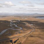
Sri Lanka is a pearl shaped island in the Indian Ocean, lying 18 miles from the southern point of India. Sri Lanka has an area of 65,000 square kilometers. It is located in the tropical zone between 5 N and 9 N latitudes and 80 E and 82 E longitudes. The island consists of two main topographical sections. The mountainous South-Central region which rises to 8,281 feet above sea level and the low-lying northern, eastern, and southwestern coastal plains.
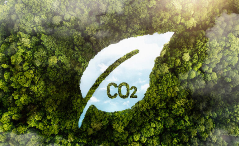
Country receives rain from two monsoons mainly. The southwest monsoon lasts roughly from May to September. During this period, the southwestern part of the island, receives much of its average annual rainfall of 100 inches. The northeast monsoon, from about October or November through February, provides the northern and eastern parts of the island virtually all their average annual rainfall of 60 inches. December through March generally proves the driest period. Climate change has caused several implications on this normal climate patterns. Rainfall changes cause flood conditions, flash floods, and high winds develop to tornados and hurricanes. On the other hand, droughts have increased to a rough, prolonged state.
Sri Lanka records a population of 21.65 million by 2023 (Worldometer, United Nations data). Among the population children, old people and individuals with health difficulties are the most vulnerable parties to the severe impacts of climate change.
Our research was carried out on five provinces, Western, Southern, Northern, Northwestern, and Eastern. Which is most vulnerable to climate change, and interestingly, all these regions are along the coastal belt. Additionally, western, southern and north western provinces mainly contribute to the national gross domestic production. We used secondary data which was taken from National Disaster Relief Service Centre and analysis and the support of literature surveys.
In this study, we compared the natural disasters which occurred in 2017 with 2020 data. As mentioned by the national disaster relief service center, 2017 was the year with most disasters reported in the last decade.
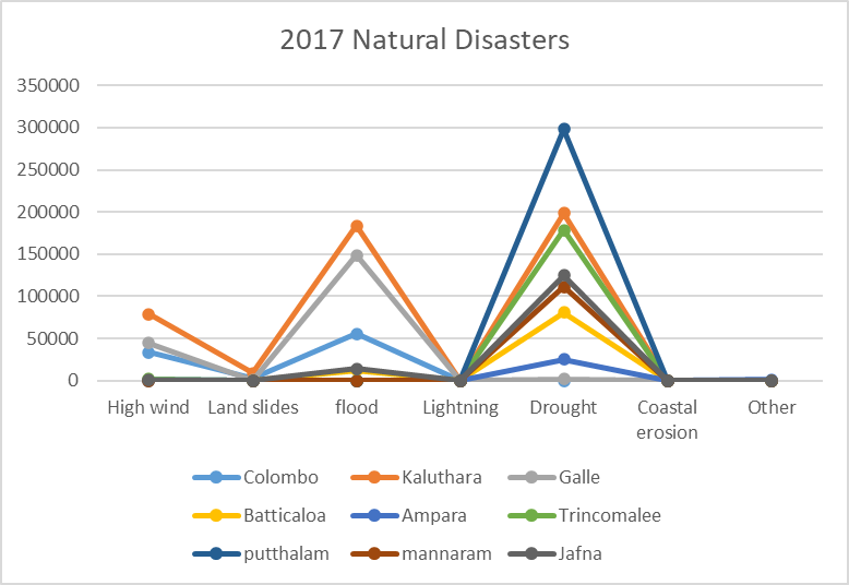
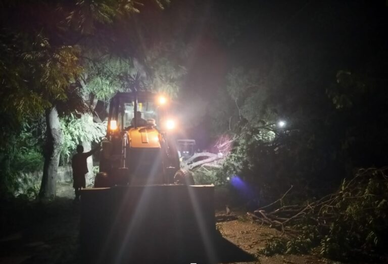
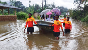
The most frequent natural hazards that affect Sri Lanka are droughts, floods, landslides, cyclones, and high winds. Also, there is a health risk such as vector borne epidemics (malaria and dengue). Floods and droughts are the main disasters that affected nearly 1,433,118 humans in 2017. When considering floods 174,257 individuals were affected. All provinces have been affected with floods. Hence, mitigatory efforts are essential. Rainfall, river flow, and topographical data can be used to construct flood hazard maps. Satellite images can be used to identify flood-prone areas with higher resolutions. However, currently satellite images are not available with required consistency, resolution, and history to create high-resolution maps.
High wind, Cyclones affect people, infrastructure, and economic activities. The North and the eastern seaboard have high food insecurity due to this condition. Landslide risks frequently affects transport by roads and railways. The National Building Research Organization (NBRO) has undertaken a detailed study of landslide risks in Sri Lanka.
Sea level rise, storm surges, and coastal erosion are greatest in the West, Southwest, and Southern coastal belt where about 50% of Sri Lanka’s population lives. Read more here. Archived
Natural Disasters of Sri Lanka, 2020
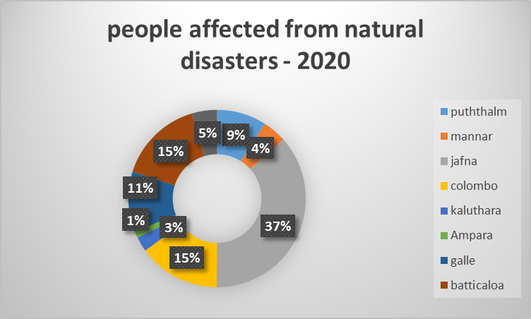
UNICEF Representative, Tim Sutton has stated that, Children, particularly the most vulnerable children, are at the heart of UNICEF’s work in Sri Lanka. Since, it is vital to help build resilience and reduce the impact of disasters on the lives of the most vulnerable children and their families. According to the data analysis, highest number of individuals affected from the Northern Province belongs to Jaffna district which is 37% and from the Western province it is Colombo district which is 15%. Galle and Batticaloa also have considerable percentages.
Health problems are prominent among the threats faced by people due to Climate Change. The health effects from physical, biological, and ecological disruptions increase the health risk of people. Climate disasters have caused and increase in respiratory and cardiovascular diseases, injuries and premature deaths. Changes in the prevalence and geographical distribution of food- and water-borne illnesses and other infectious diseases increasingly threaten people’s health conditions in addition to climate anxiety and mental health issues.
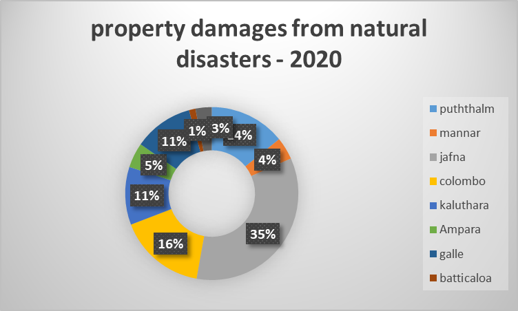
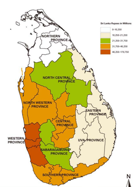
Natural disasters also cause a huge damage to the economy. According to our analysis all provinces face economic damages. Jaffna ranked highest in property damages caused with a percentage of 35%. Colombo, Galle, Kalutara and Puttalam also have considerable economic damage. Accordingly, Sri Lanka need to focus on climate change adaptation, techniques, mitigation plans to become more resilient.