Physical Address
23,24,25 & 26, 2nd Floor, Software Technology Park India, Opp: Garware Stadium,MIDC, Chikalthana, Aurangabad, Maharashtra – 431001 India
Physical Address
23,24,25 & 26, 2nd Floor, Software Technology Park India, Opp: Garware Stadium,MIDC, Chikalthana, Aurangabad, Maharashtra – 431001 India

By Aayushi Sharma
The India Meteorological Department (IMD) has predicted a wetter-than-usual September for several parts of North India, driven by the anticipated onset of La Niña—a cooling of the central Pacific Ocean. According to Mrutunjay Mohapatra, Director General of IMD, this climatic phenomenon is expected to lead to vigorous cyclonic activity in the Bay of Bengal, resulting in multiple episodes of rainfall throughout the month.
IMD in the press release mentioned that “Above-normal rainfall is likely over most parts of India, except some parts of the extreme north India, many parts of south Peninsular India, and most parts of northeast India where normal to below-normal rainfall is likely. Monthly rainfall for September 2024 over the country as a whole is most likely to be above normal (>109 % of the Long Period Average (LPA)).”
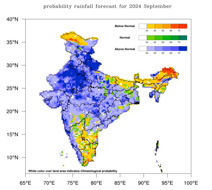
Monsoon rains in September are forecasted to be 9% above the usual 16.8 cm average, with heavy downpours expected in regions such as Rajasthan, Uttarakhand, and Delhi. Despite the monsoon typically beginning to withdraw by mid-September, Dr. Mohapatra emphasized that it’s too early to predict the exact timing of the withdrawal due to the anticipated heavy rains.
The IMD’s models also indicate the formation of at least four cyclone precursors in the coming month. Meanwhile, Cyclonic Storm Asna, which had been affecting the Gujarat coast, is expected to dissipate by September 2, as it moves away into the north-central Arabian Sea. Reflecting on the past month, Dr. Mohapatra noted that August saw 15% more rainfall than usual, surpassing the IMD’s earlier forecast of a 6% increase. The month was marked by the formation of six low-pressure systems, which contributed to the heavy and uninterrupted rains.
What impact does La Nina have on the regions?
During La Niña years, the Southeast tends to experience warmer than normal temperatures, while the Northwest tends to be cooler than normal. La Niña leads to higher-than-average sea-surface temperatures in the southern Pacific Ocean near northern Australia, New Guinea, and the Indonesian islands.
A depression currently over the northwest Bay of Bengal is projected to cross northern Andhra Pradesh later on Saturday, though it is not expected to develop into a cyclone. As the La Niña effect intensifies, India may continue to experience unusual weather patterns in the coming weeks.
References:
https://internal.imd.gov.in/press_release/20240831_pr_3232.pdf
https://internal.imd.gov.in/press_release/20240831_pr_3227.pdf
What is the La Niña effect? How is it different from El Niño?
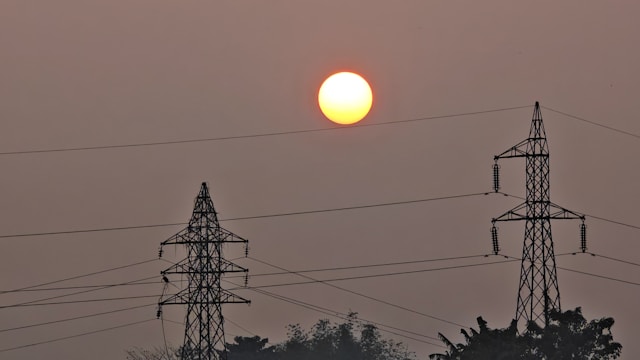
Banner Image: Photo by Siddique Sk on Pexels